Autonomy, one generation at a time
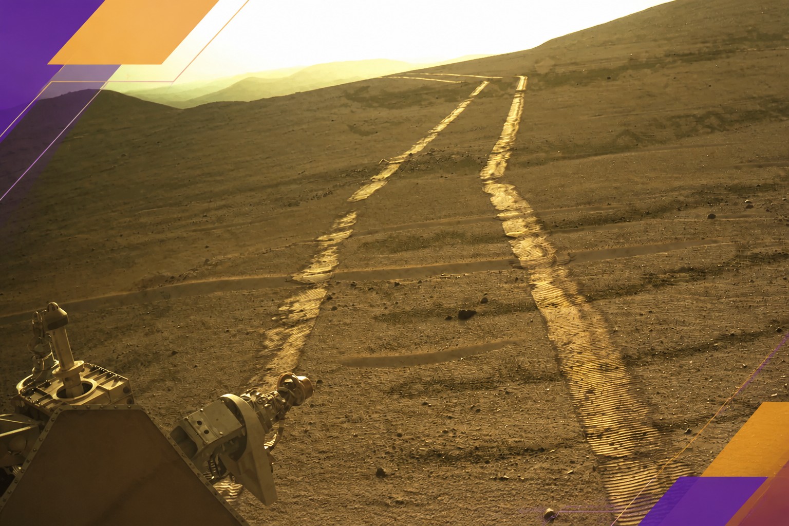
Opportunity reached Mars in January 2004 for a three-month mission and kept working for 15 years, until February 2019. A planetary dust storm stopped it in Perseverance Valley. Its 45.16 kilometres stood as the distance record until Perseverance passed it.
Perseverance arrived on 18 February 2021, carrying the Ingenuity helicopter beneath its body. It joined Curiosity, which has been operating on Mars since 2012. Both rovers use radioisotope thermoelectric generators rather than the solar panels used by Opportunity.
Perseverance’s stronger wheels helped, but its design for autonomous driving mattered more. The progression has been substantial:
Source: spectrum.ieee.org
The animation shows Perseverance travelling 807 feet — 246 metres — along the rim of Jezero crater on 10 December 2025, the mission’s 1,709th Martian day. It covers two hours and 35 minutes. To reconstruct the drive, engineers used 53 pairs of navigation-camera images, rover orientation, wheel speed and steering angle, and inertial measurement data. They placed the material in a 3D virtual environment and added frames at roughly every four inches — 0.1 metres — of travel. JPL-Caltech/NASA
The rover’s AutoNav system can move at nearly full speed, up to 120 metres per hour. But its autonomy has limits: the onboard system evaluates the shape of the surface, not the type of soil. Human teams still use orbital maps and experience to steer it away from terrain that could trap it.
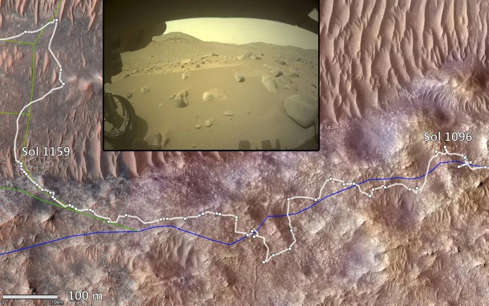
The science team sets a destination. Engineers plan a route using lower-resolution orbital maps, then the tactical operations team combines that route with the day’s science tasks. Planners also mark specific areas for the rover to avoid. Intersecting sand ridges, for example, have caused it to start sinking; the rover cannot recognise that ground type by itself.
Orbital images can reach a resolution of 25 centimetres, but a large rock may occupy only one or two pixels. The rover needs autonomous navigation to handle obstacles that are hard to see from orbit, while human guidance helps it choose a better route before it gets there.
Source: spectrum.ieee.org
This orbital image shows difficult terrain that Perseverance could not traverse autonomously. The blue line is the route planned by humans; the white line is the rover’s actual path. The inset, from a hazard-avoidance camera, shows rocky, sandy and sloping ground. Original images: Olivier Toupet, Masahiro Ono and others; JPL-Caltech/University of Arizona/NASA
Where the system stops
On one difficult stretch, the team stopped using autonomous driving for about two months while it tuned the system and wrote software for unfamiliar terrain. Some changes were quick; others took months of study. One key setting limits the steepest slope the rover can climb, since it could slide sideways on a sharp incline.
Perseverance landed on flat ground in Jezero crater, and for its first three years most routes had slopes below 14 degrees. Leaving the crater brought steeper slopes and more rocks. The team used what it learned to adjust the rover’s settings so it could handle slopes of up to 24 degrees.
Source: spectrum.ieee.org
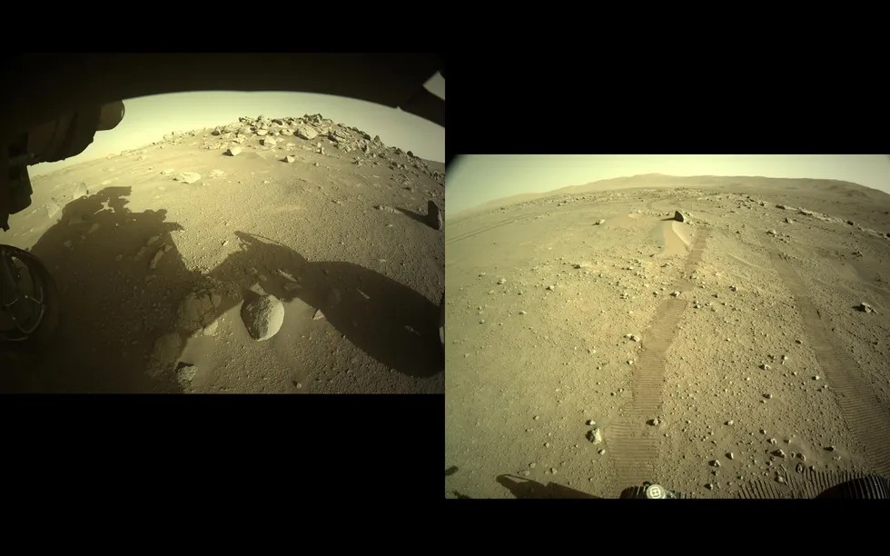
These images from hazard-avoidance and navigation cameras show Perseverance’s first AutoNav drives. On the left, the rover stopped on its own in front of piles of rocks. On the right, it successfully drove around a rock during its second trip. JPL-Caltech/NASA
The distinction matters: autonomous driving is not the same as autonomous exploration. In late 2025, Mark Maimone’s team asked Anthropic’s Claude to study orbital images and plan a 400-metre drive. The AI produced a starting route; the human team checked it and made several changes. Maimone said it was faster to review that proposal than to plan a route from scratch.
I think that is the more useful measure of AI in this mission: not whether it replaces the planners, but whether it gives them a reliable first draft. The announcement is quieter about how much work remains between a route the system can follow and a mission it can run on its own.
Maimone said uncertainty in the rover’s position builds up as it drives. As uncertainty grows, the rover must stay farther from areas humans have marked as potentially dangerous. Those “keep-out zones” can eventually expand until no safe route remains.
Perseverance has a feature called Mars Global Localization to reduce that uncertainty by comparing its position with maps and keep-out zones. In theory, Maimone said, the rover could then drive safely for as long as its resources allow. But weeks of independent operation would also require it to carry out science on its own: process images onboard, interpret its surroundings and decide where to point its instruments.
The 45.22-kilometre record shows how far autonomous driving has come, not that human oversight is close to obsolete. The next test is whether the rover can turn a longer drive into a longer stretch of independent science.
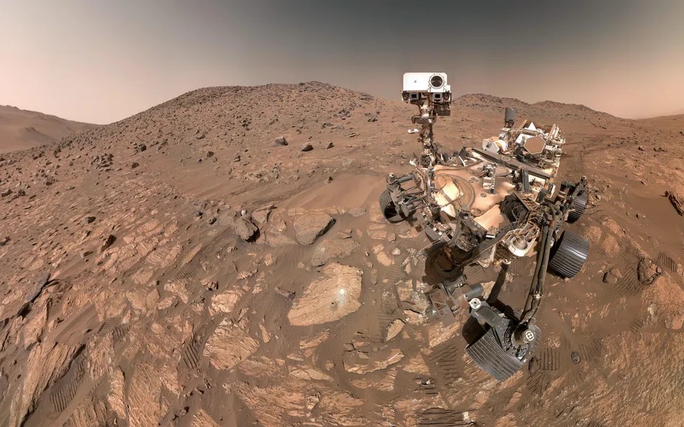
Perseverance took this selfie on 23 July 2024. It combines 62 images captured by WATSON, the Wide Angle Topographic Sensor for Operations and eNgineering, mounted at the end of the robotic arm. JPL-Caltech/MSSS/NASA
Daily AI news
Every day we pick what actually matters in AI and explain it plainly — no hype, no filler. Subscribe if you want to follow where the industry is going.
Only what matters — every day
Follow on X