
Source: technologyreview.com
What the investigation could establish
The project, titled “Death on Camera,” began with a simple question: why were so many people dying near government observation towers designed to detect and apprehend border crossers?
The journalists:
They studied deaths from 2015 onward, covering different border policies, presidential administrations and generations of surveillance towers.
The U.S.-Mexico border is considered the deadliest land border in the world. Border Patrol estimates that more than 10,000 people have died while attempting to cross since 2000, a figure generally considered an undercount.
The investigation included a death only when three facts could be established:
The final dataset combined existing records from No More Deaths, Humane Borders and the Electronic Frontier Foundation with new records obtained from more than a dozen government agencies.
That process exposed a basic problem before the tower analysis even began: there is no single national system for recording migrant deaths. Some remains are never found. Public records vary widely in their location data, dates and information about the deceased.
Building a death record
Texas was the largest gap in the existing datasets. Unlike Arizona, it does not support an initiative to publish these records online. Unlike New Mexico, it leaves death investigations to individual counties.
The journalists requested records from all 17 Texas counties that had areas covered by surveillance towers:
Deaths in other Texas counties were excluded because they did not contain areas covered by the towers in the analysis.
In most of these counties, elected justices of the peace collect the most complete local death records. Requests to those offices can remain unanswered for years. Some of the journalists’ requests were still incomplete more than a year after they were sent.
Justice-of-the-peace reports also sometimes lacked the location where remains were found. Some officials did not visit the scene, instead completing the death investigation by video call with emergency personnel who were there.
Beginning in July 2025, MIT Technology Review therefore sent requests to the sheriffs of all 17 counties. Sheriffs are often among the first officials to arrive where a body is found, and their reports can contain more precise location data.
The approach also understates the number of migrant deaths in Texas because it does not include cases handled by local or state police.
The records arrived between July 2025 and February 2026. Agencies often did not say when their information was last updated. They warned that archives were incomplete: an unknown number of documents had been lost during office moves, damaged, destroyed or transferred incorrectly when a sheriff changed.
The records also rarely identified whether a deceased person had been attempting to cross the border. That omission existed even in counties with detailed fields for other circumstances. Zapata County reports, for example, could record whether jewelry was stolen during a robbery. Cameron County reports could record whether a burglar entered through a chimney.
Finding migrant deaths therefore required employees and journalists to read the documents manually, making the process slower, more expensive and more vulnerable to error.
Records usable for the analysis came from 14 counties. Documents from Dimmit and Duval had not arrived, while Maverick County charged for each record, making the request too expensive.
The agencies supplied more than 4,000 pages of police reports, including handwritten documents. For Kenedy, Webb and Hidalgo counties, the volume was large enough that the journalists used Anthropic’s Claude through an API for an initial review. The model extracted coordinates for locations where remains were found, after which journalists manually checked groups of cases to assess its accuracy.
They excluded several hundred cases without enough information to locate the remains precisely. Fewer than 100 cases lacked coordinates but included descriptions accurate to within 0.25 miles, so those remained in the dataset.
Texas records also tended to contain less information than records from other border states about how long a person may have been dead before the remains were found. Autopsy reports sometimes offered more detail, but many autopsies in southern Texas are conducted by the Webb County medical examiner, who charges for each report. That cost was too high for an analysis of this scale.
MIT Technology Review consulted Greg Hess, director of the Pima County Office of the Medical Examiner in Arizona. He helped develop a method for converting descriptions of the scene, the body and the cause of death into approximate estimates of the time of death.
More than 1,500 Texas cases entered the final analysis.
Arizona supplied another major part of the dataset. The Pima County Office of the Medical Examiner investigates deaths in every Arizona border county except Yuma County. No More Deaths supplied the Yuma records.
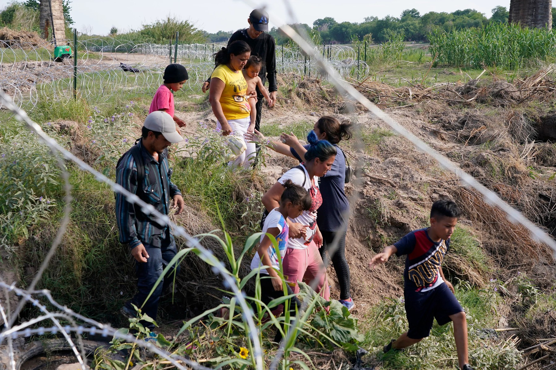
Migrants, most with children, follow a path along the concertina wire where ultimately they will placed under guard by Border Patrol after having crossed the Rio Grande on May 27, 2022 in Eagle Pass, Texas.
Source: technologyreview.com
The Pima office decides which cases it believes are connected to people crossing the border, publishes a migrant-death data portal and updates it monthly. It then sends the data to Humane Borders, which publishes it as a map and database.
The analysis included Arizona records from 2015 through April 2026. Humane Borders records the precision of the location where remains were found, and the journalists included only cases with coordinates accurate to 300 feet. More than 1,700 cases from the Humane Borders database entered the analysis.
For California, New Mexico, Yuma County, El Paso County and Hudspeth County, the journalists used records from No More Deaths, which has tracked migrant deaths since 2004 and publishes information about its requests and methods.
The organization’s data included GPS coordinates in many cases. The journalists included only locations known to within 0.25 miles. Where possible, the records also described the degree of decomposition, which helped estimate the time of death with Greg Hess’s methodology.
The sources covered different periods:
Nearly 1,000 cases came from the No More Deaths database. After combining all sources and removing deaths whose locations could not be identified precisely enough, the investigation analyzed nearly 4,000 cases.
The journalists treated the location where remains were found as the place of death. That assumption can be wrong: remains can be moved by people, water or animals. Medical examiners and researchers interviewed for the project considered such cases rare.
They also excluded deaths that appeared unrelated to the virtual wall, including deaths inside Border Patrol stations and deaths in vehicle crashes during pursuits. Different causes of death remained in the dataset because each could have produced a warning that allowed Border Patrol to intervene. A person dying slowly from dehydration within camera range had more time for intervention than someone who drowned quickly in a river or canal, but both cases represented a possible failure to act on an available signal.
Mapping the towers
To include a tower, the journalists needed three things:
The Electronic Frontier Foundation has tracked and mapped Border Patrol surveillance towers since 2023 using field observations, satellite imagery and government records obtained through public-records requests.
Its list is incomplete. Government documents indicate that about 800 towers are currently deployed, while the Electronic Frontier Foundation has documented roughly 600. Deaths near towers not yet catalogued by the organization therefore do not appear in the analysis.
MIT Technology Review worked closely with Dave Maass, the Electronic Frontier Foundation’s investigations director. The journalists used the organization’s database published in April 2026, then added towers that had already been dismantled after obtaining information about them from the organization. They checked every tower coordinate against satellite imagery.
The analysis focused on three main tower types. Other mapped objects were excluded because their viewing range was difficult to establish, including some towers at checkpoints and Border Patrol stations.
To estimate viewing distances, the journalists reviewed technology-company materials, Electronic Frontier Foundation research and government documents, and spoke with former Border Patrol employees and managers. The distances were consistent across sources, but they were advertising estimates rather than contractual guarantees. Some government documents withheld more precise information about individual towers for security reasons.
The installation dates came from satellite imagery. Dave Maass had previously estimated when some towers appeared. MIT Technology Review checked those dates and reviewed the remaining objects, recording the first date each tower appeared and, when it later disappeared, the last date it was visible.
The journalists compared imagery from different sources for months. Anduril towers were generally easier to date because they were installed on previously empty desert sites, where new solar panels and structures stood out. Other towers, including IFT systems, were often built on or beside existing infrastructure, requiring more reliance on the Electronic Frontier Foundation’s image-analysis experience.
When satellite imagery was insufficient, the journalists used Google Street View, government documents and photographs collected by the Electronic Frontier Foundation.
The method has a significant blind spot. Historical images are not available for every day, and gaps of months or even a year occur for older towers and remote locations. A tower visible in May and December could theoretically have disappeared and returned between those dates.
Several Border Patrol employees told the journalists that even mobile towers, including autonomous ones, were rarely dismantled or moved in practice. The journalists also observed semi-permanent fencing appearing around many Anduril towers.
Still, a tower visible in an image was not necessarily switched on. The data cannot show whether it had power, was operating or transmitting information. It establishes when a tower was present, not whether it was functional.
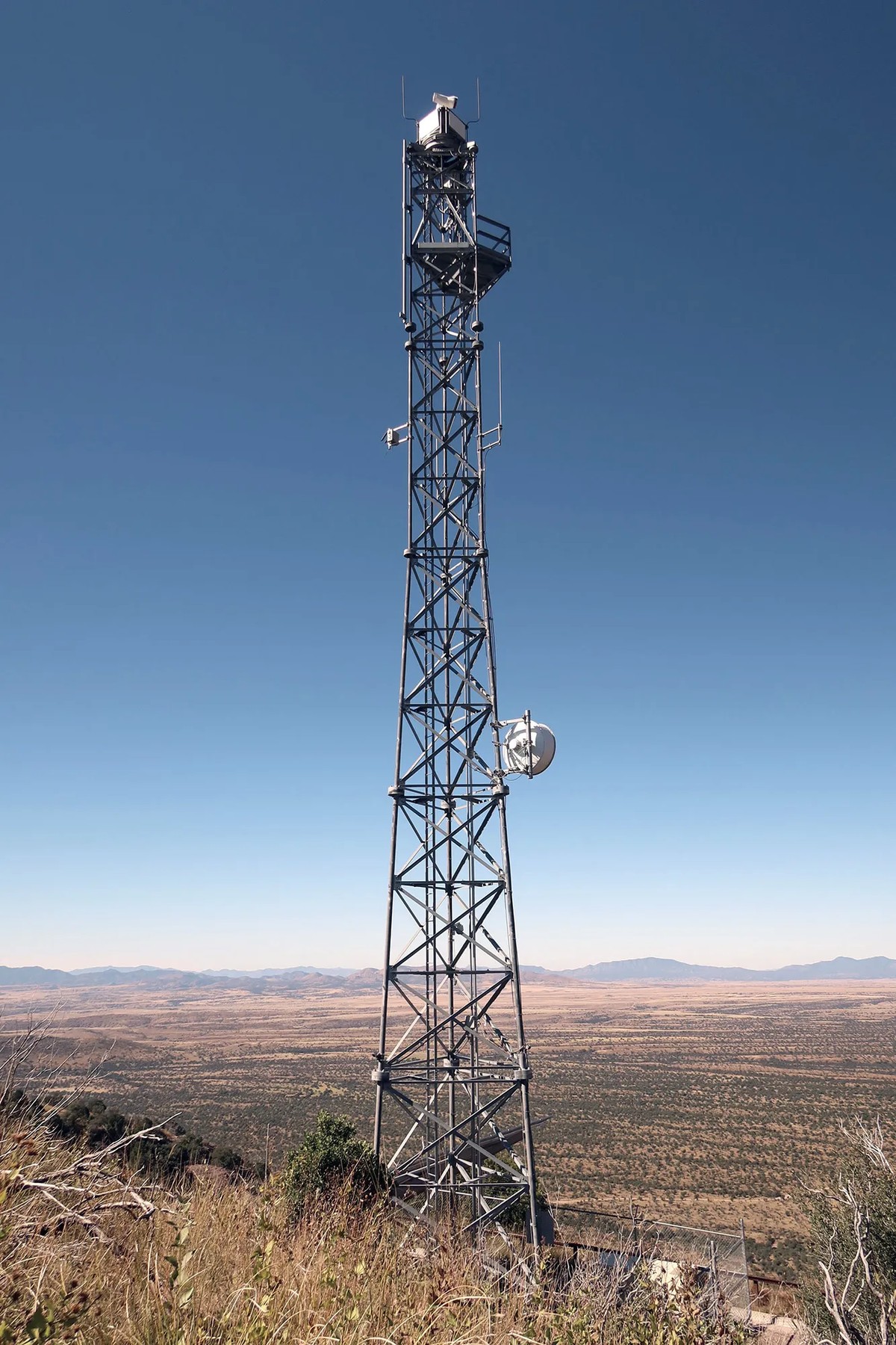
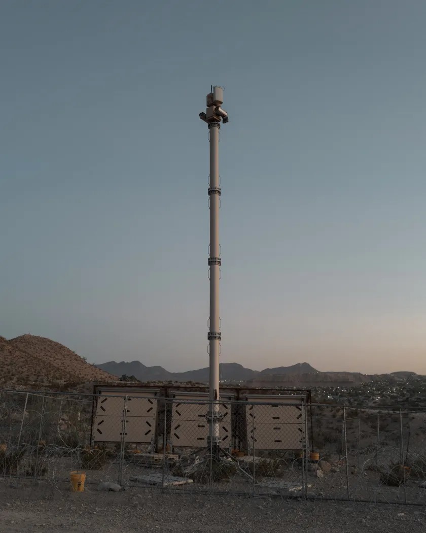
An integrated fixed tower (IFT) on Coronado Peak, Cochise County, Arizona.
Source: technologyreview.com
Matching deaths to cameras
A death was counted as occurring within the virtual wall only when two conditions were met:
Minho Kim, an external project contributor and current Stanford University postdoctoral researcher specializing in wildfire mapping, analyzed the distances. His program loaded the remains database and tower database, generated a row for each case near a tower and calculated the distance between them.
The journalists then checked whether the tower existed when the person was believed to have died.
Some Arizona records already contained a time-of-death estimate, such as more than three weeks but less than five weeks before the remains were found. In other cases, the journalists estimated the interval from decomposition, the cause of death or both. They reviewed police reports, photographs, news coverage, expert interviews and decomposition timelines.
The intervals are approximate, but they were the most precise estimates available from the records.
Cases received different confidence levels depending on how the dates aligned. If the entire estimated death interval began well after a tower first appeared, the journalists treated the tower as probably present. If any part of the interval preceded the tower’s appearance, they excluded the case.
Many cases involved skeletonized remains. Because decomposition varies with location and season, the journalists used a conservative three-year threshold when no more specific estimate was available:
The assumption was that it was unlikely for someone to die before a tower was installed and remain undiscovered for another three years.
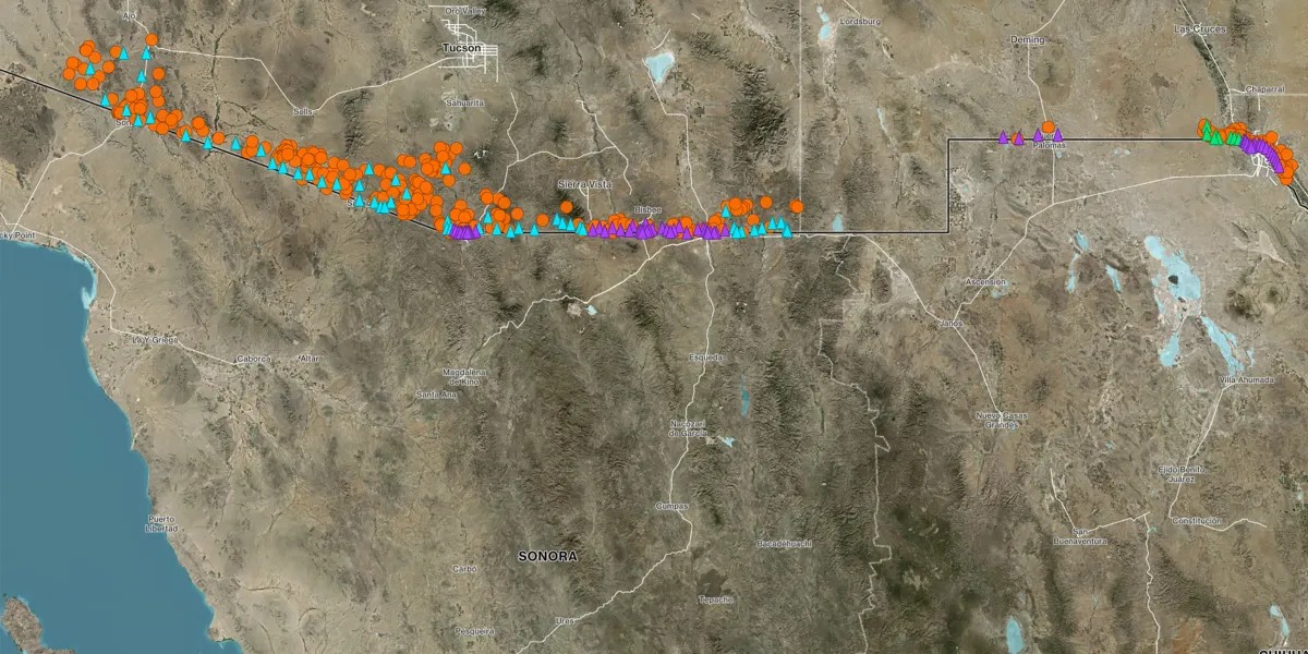
The map therefore measures an opportunity for detection, not detection itself. The distinction matters: proximity to a camera cannot establish that the camera saw a person, that an alert was generated or that an agent received one.
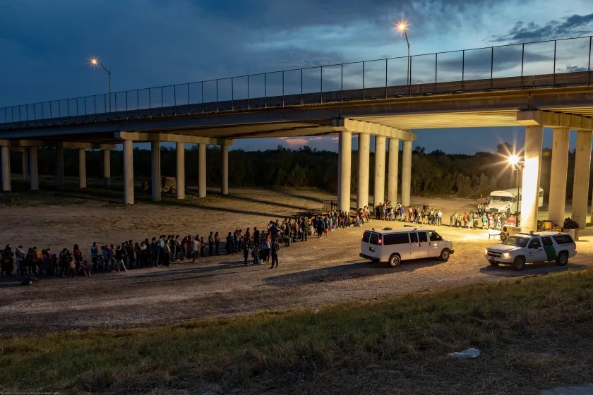
As the sun sets near McAllen TX, migrants that have crossed the Rio Grande surrender to U.S. Border Patrol near an area known as Rincon.
Source: technologyreview.com
What the map cannot show
Terrain, vegetation and buildings can hide a person from a tower.
For the terrain analysis, the border region was divided into a grid, with an elevation assigned to each cell. For each remains-and-tower pair, the journalists drew a line between the tower’s estimated height and the assumed height of the deceased person—5 feet 6 inches.
If the terrain rose high enough to block that line, the view was classified as obstructed. Otherwise, it was classified as open.
The model is a rough estimate. Each cell in the elevation data represents a 30-meter-wide area, or approximately 98 feet, and receives only one elevation value. Small changes in steep or irregular terrain can therefore disappear.
The journalists show both outcomes on the map: locations where the line of sight was estimated to be open and locations where terrain probably blocked it. Even when a death site was hidden, the person could have crossed an area visible to the tower before reaching that location.
Vegetation is harder to model. The journalists considered it a less significant limitation because the virtual wall’s towers use thermal cameras that can detect body heat through light vegetation. Dense vegetation can still block the view.
Buildings pose a more serious problem. Their location and height could not be incorporated reliably, so the journalists inspected each tower’s surroundings and marked towers in or near cities to warn that buildings might limit visibility.
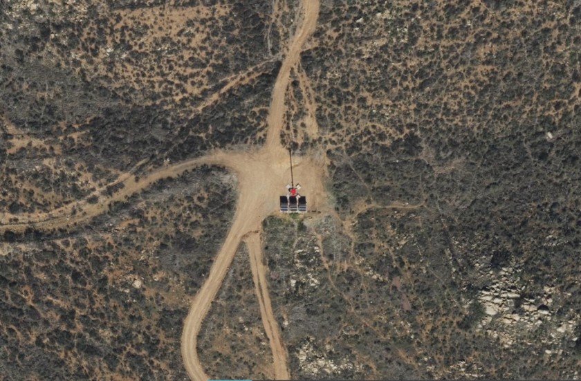
An autonomous surveillance tower from Anduril captured January 6, 2022.
Source: technologyreview.com
The central question for each case—and for the families of the dead—is whether the U.S. government detected someone attempting to cross but failed to intercept them, or never detected them at all.
The available data cannot answer that. Border Patrol does not disclose which signals arrived before a particular migrant death. Camera recordings are not retained unless an internal investigation begins, and such investigations are conducted only when a migrant dies in custody.
To understand how the systems are used, MIT Technology Review interviewed dozens of current and former employees of Border Patrol, Customs and Border Protection and the Department of Homeland Security, as well as former presidential advisers. The interviews produced previously unpublished information about surveillance practices, examples of inadequate system performance and evidence that the agencies rarely test the effectiveness of these technologies internally.
The journalists also searched for friends and relatives of people who died near towers using additional records, social media and other research tools. Interviews were conducted according to trauma-informed journalism principles.
Since September 2025, MIT Technology Review had requested interviews with current Border Patrol staff and leadership and sought permission to visit the border to study the strengths and weaknesses of the agency’s newest autonomous-tower program.
In July 2026, after delays partly related to disruptions in Department of Homeland Security funding, the journalists were told that their visit had received local approval in the Big Bend area of Texas. They wanted to go because Border Patrol is expanding the number of Anduril towers there.
After the request was sent to Department of Homeland Security headquarters for final approval, however, the agency denied access.
Before publication, the journalists sent detailed questions to Border Patrol, Anduril, General Dynamics and Elbit. Border Patrol and Anduril responded without addressing the questions substantively. General Dynamics referred the journalists to Border Patrol. Elbit did not respond.
The investigation’s most consequential finding may be methodological rather than numerical. A map can show that a death occurred close enough to a tower, at a time when the tower was likely present. It cannot show whether the camera was powered, whether an alert reached an operator, whether the operator understood it or whether anyone had a realistic chance to intervene.
That missing chain is where the accountability question begins—and where the public record ends.
Daily AI news
Every day we pick what actually matters in AI and explain it plainly — no hype, no filler. Subscribe if you want to follow where the industry is going.
Only what matters — every day
Follow on X